

DEP Program Areas
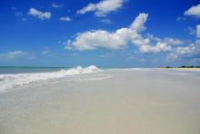
Florida Coastal Access Guide
A guide to public coastal access points along the entire Florida coast from the Gulf of Mexico to the Atlantic Ocean
Florida Coastal Management Program
Coordinates local, state and federal agency activities using existing laws to protect coastal resources.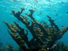
Florida Keys National Marine Sanctuary
Florida Keys National Marine Sanctuary protects 2,900 square nautical miles of waters surrounding the Florida Keys, from Biscayne Bay westward to the Dry Tortugas.
Florida Resilient Coastlines Program - Home
Through the Florida Resilient Coastlines Program, DEP continues its efforts to help ensure collaboration among Florida’s coastal communities and to offer technical assistance and funding to coastal communities dealing with increasingly complex flooding, erosion and habitat shifts. Local communities can assess vulnerabilities to projected increases in coastal flooding and erosion and can develop
National Estuarine Research Reserves - Apalachicola
The research reserve includes the lower 52 miles of the Apalachicola River and floodplain as well as most of Apalachicola Bay.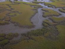
National Estuarine Research Reserves - Guana - Tolomato - Matanzas
The GTM Research Reserve protects 76,760 acres south of Jacksonville on Florida's northeast coast.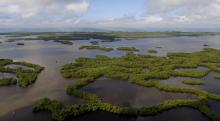
National Estuarine Research Reserves - Rookery Bay
Located at the northern end of the Ten Thousand Islands on the Gulf Coast of Florida, the research reserve includes one of the few remaining undisturbed mangrove estuaries in North America.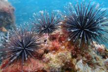
Outer Continental Shelf Program
DEP oversees activities in federal waters on the Outer Continental Shelf to ensure consistency with state laws and policies.
Resilient Florida Program
Updates: Pre Application assistance, including virtual office hours, for the 2024 application cycle begins. See the program resources page for full details. NEW! 2023-2024 Resilient Florida Planning Grant Awards now available! NEW! 2024-2025 Statewide Resilience Plan now available! DEP's Comprehensive Statewide Flood Vulnerability and Sea Level Rise Data Set Final Report is now available. A GISInterested in subscribing to DEP newsletters or receiving DEP updates through email?
Sign UpThe Florida Department of Environmental Protection is the state’s lead agency for environmental management and stewardship – protecting our air, water and land. The vision of the Florida Department of Environmental Protection is to create strong community partnerships, safeguard Florida’s natural resources and enhance its ecosystems.
Learn More
3900 Commonwealth Boulevard
Tallahassee, Florida 32399-3000 Public.Services@FloridaDEP.gov 850-245-2118
Tallahassee, Florida 32399-3000 Public.Services@FloridaDEP.gov 850-245-2118