The Division of Recreation and Parks’ Mapping and Database Management Section contains nearly a ½ terabyte of data in approximately 250,000 digital files. Geographic Information Systems (GIS) is best described as a system to analyze, store, manipulate and present spatial data. Effective management requires a well-organized, comprehensive repository of assets located in state parks.

The Mapping and Database Section’s GIS performs this role, as it continually maintains and publishes inventories of recreational, natural, cultural and operational spatial data that represent the entire state park system. The responsibilities of the mapping and database section include:

  • Boundary location for almost 800,000 acres of Division of Recreation and Parks Managed Areas - 175 parks and trails.
  • Land acquisition and property information on over 7,000 parcels.
  • Management plan mapping.
  • 4,700+ structures.
  • 4,800+ management zones.
  • 3,000 miles of roads.
  • 2,000 miles of trails.
  • 30,000 unique natural communities polygons classified into 95 distinct standardized ecosystem types.
  • High-resolution elevation data.
  • Land Management Uniform Accounting Council Report, Jurisdiction Report, Recreation Facility Inventory, proceeds on bond-financed lands and business metrics.
  • Natural resources tracking system.
  • Emergency response and damage assessment.

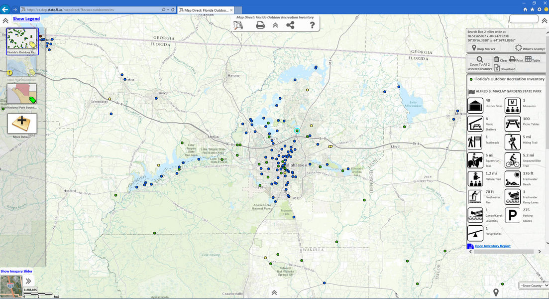
Florida State Parks Map Direct is a public online map, featured on FloridaStateParks.org. It is mobile-friendly, GPS-active and displays the information most useful to park visitors, such as park entrances, points of interest, structures and trails. This is one of the most comprehensive and accessible web-based online park maps of its kind. It is an ongoing collaborative effort between the Division of Recreation and Parks Mapping and Database Section and the Office of Technology and Information Services GIS section.

View Fullscreen Parks Map

Image
A screenshot of the Outdoor Recreation Inventory Map Direct application showing locations in Leon County, Florida.
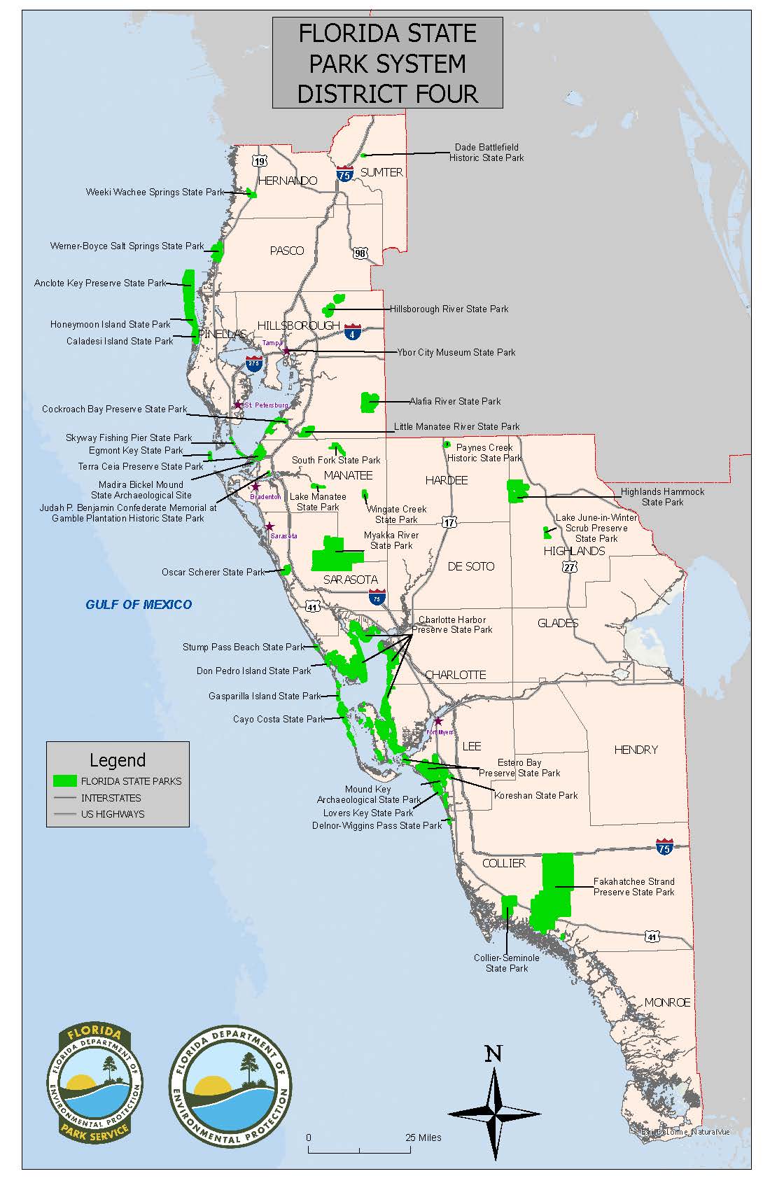
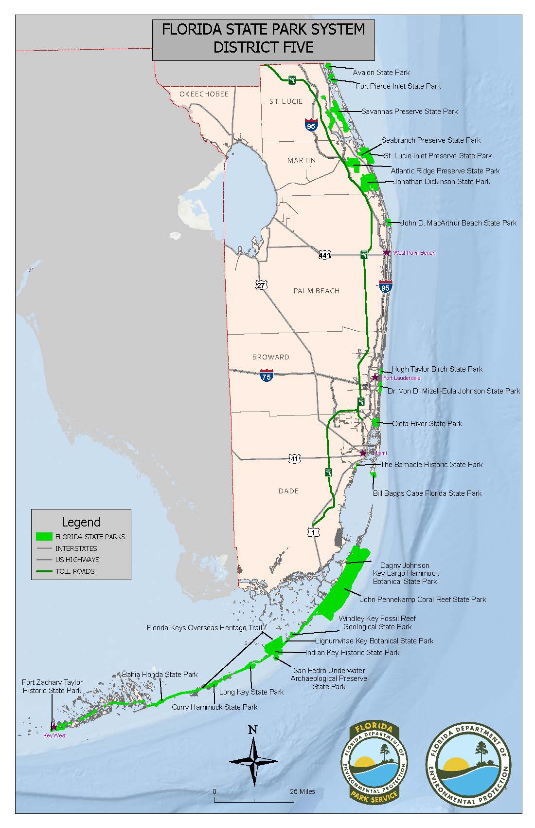
The mapping and database section provides maps and data for public and internal information requests and provides other technical support to division staff. Below are the graphic links for the most common information requests for state park and district location information.

Florida State Parks - Administrative Districts

District 1 Map

District 2 Map

District 3 Map

District 4 Map

District 5 Map

Image
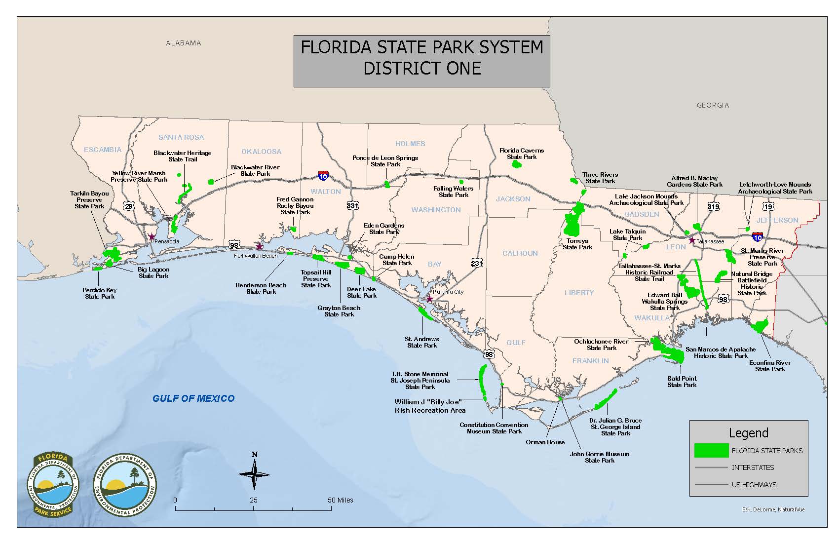
Florida State Parks District 1 Map
Image
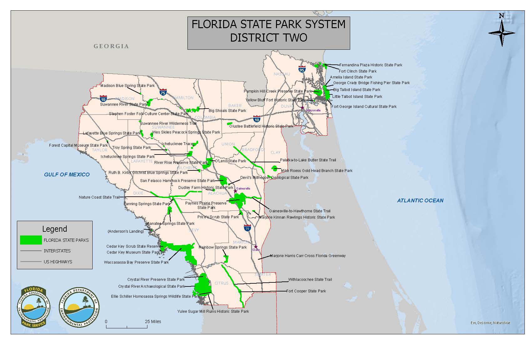
Florida State Parks District 2 Map
Image
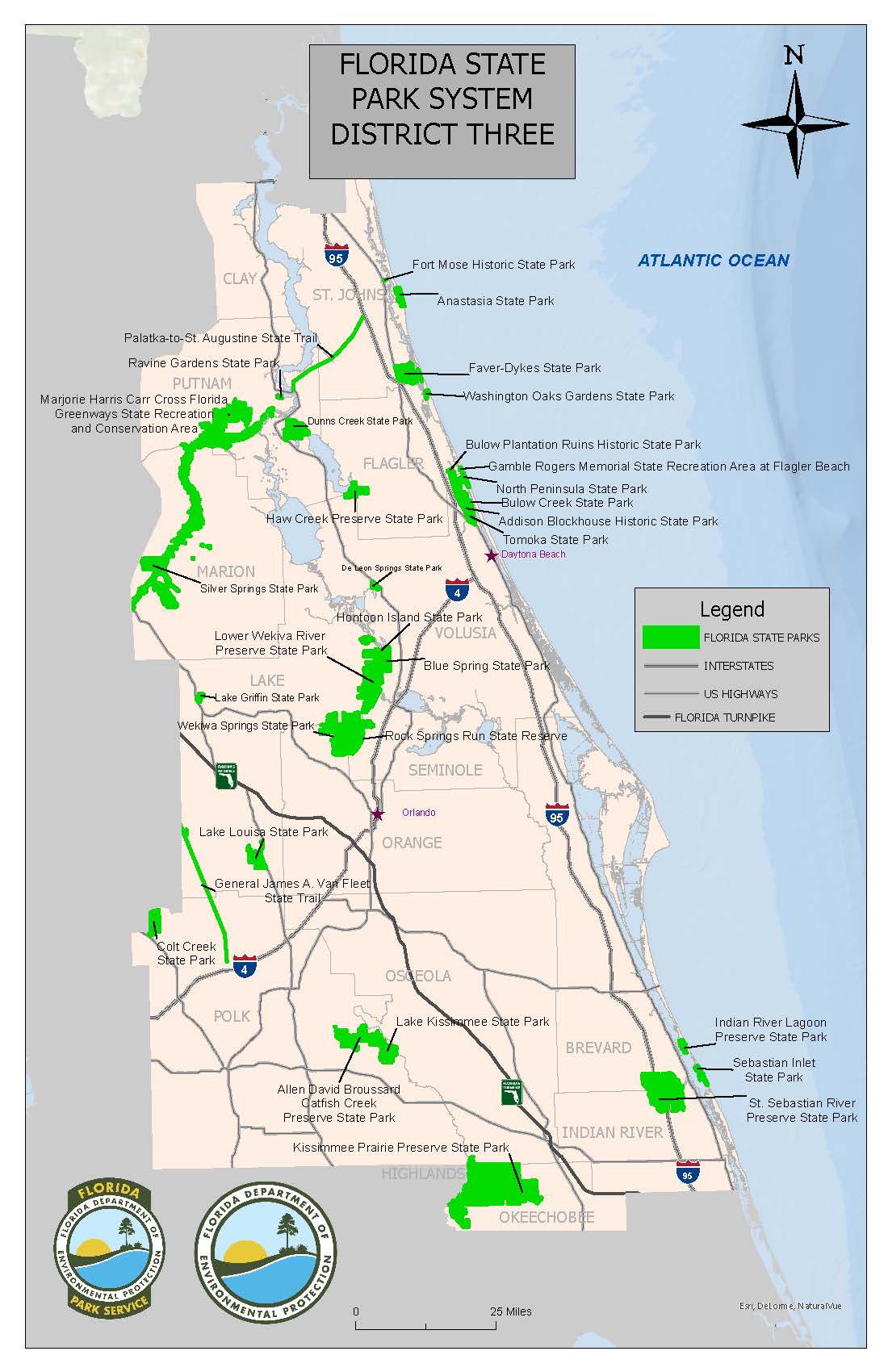
Florida State Parks District 3 Map
Image
Florida State Parks District 4 Map
Image
Florida State Parks District 5 Map


Statewide Map

Image
State Parks System map 2023

Contact Us

Florida Department of Environmental Protection
Division of Recreation and Parks
GIS and Database Management
3800 Commonwealth Blvd., MS 525
Tallahassee, FL 32399
850-245-3059