
Tomoka Marsh Aquatic Preserve

The Tomoka Marsh Aquatic Preserve is an estuarine system composed of five distinct areas that includes portions of the Halifax River, Smith Creek, Bulow Creek, the Tomoka River and the Tomoka Basin. The threatened West Indian manatee is a summer resident of the area, traveling in the Halifax and Tomoka rivers.
Approximately 7 miles of the Halifax River, north from the southern boundary of Ormond-by-the-Sea, is designated as the aquatic preserve. The Halifax is a long, wide, shallow estuarine lagoon bounded on the west by the Florida mainland and on the east by a barrier island. The estuary is created by the mixing of saltwater from the Atlantic Ocean, introduced through the Matanzas inlet to the north and the Ponce de León Inlet to the south, with freshwater from the Tomoka River, Bulow Creek and the upper Halifax River drainage basin.
The Halifax River is part of the Atlantic Intracoastal Waterway, which is 125 feet wide and dredged to a depth of 12 feet.
Smith Creek is a shallow, estuarine creek with numerous oyster beds. Portions of the creek's natural channel were dredged to accommodate the Intracoastal Waterway. The remaining natural channel is primarily salt marsh, interspersed with small islands, both natural and created.
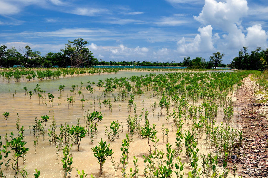
 grows at the landward edge of a brackish salt marsh with black needle rush (Juncus roemerianus) and salt grass (Distichlis spicata).")
Bulow Creek is a shallow, meandering waterway bordered by marsh and floodplain hardwood trees. From its origin in vast wetlands to the north, the creek flows south for about 4 miles, meandering to its confluence with the Halifax River. Large expanses of black needlerush border the creek.
The Tomoka River watershed drains an area of about 150 square miles, making it one of the largest sub-basins in the Florida East Coast Basin. Numerous human-made canals have increased the boundary of the Tomoka watershed. The natural headwaters of the Tomoka River originate in low-lying areas south of Interstate 4 and west of I-95. From its natural headwaters, the river flows generally north-northeast until its confluence with the Halifax River at the Tomoka Basin. The Tomoka River east of U.S. 1 is designated as a aquatic preserve.
The Tomoka Basin is about 365 acres of shallow estuarine bay, located at the confluence of the Tomoka and Halifax rivers.
Location
Northeast coast of Florida, along the Tomoka River and portions of the Halifax River, in Flagler and Volusia counties, between the towns of Ormond Beach and Flagler Beach
FL
United States
Tomoka Marsh offers excellent opportunities for nature and water-based recreation, such as boating, fishing, kayaking, canoeing and bird-watching. There are boat ramps at Bulow Plantation Ruins Historic State Park, Tomoka State Park and Gamble Rogers Memorial State Recreation Area. Canoe rentals are available at Tomoka State Park.
There is access to Bulow Creek from a parking area off Walter Boardman Lane and off High Bridge Road. However, the Halifax River is heavily used by boats navigating the Intracoastal Waterway. Hiking trails and a campground in Tomoka State Park border the preserve.
The beaches at nearby Gamble Rogers Memorial State Recreation Area at Flagler Beach and North Peninsula state parks are also popular destinations.
The Tomoka area has important archaeological and historical resources. About 70 historical and prehistoric sites are located near the aquatic preserve, including the remains of Nocoroco, a Timucuan village, within Tomoka State Park and the remains of plantations at Bulow Plantation Ruins Historic State Park.
Interested in subscribing to DEP newsletters or receiving DEP updates through email?
Sign UpThe Florida Department of Environmental Protection is the state’s lead agency for environmental management and stewardship – protecting our air, water and land. The vision of the Florida Department of Environmental Protection is to create strong community partnerships, safeguard Florida’s natural resources and enhance its ecosystems.
Learn MoreTallahassee, Florida 32399-3000 Public.Services@FloridaDEP.gov 850-245-2118
